Online Resources
Social Media Links
City of Walsenburg
Huerfano Emergency Dispatch
One Huerfano
Town of La Veta
Huerfano County PIO
Huerfano County Emergency Dispatch
Useful Websites
Drone Video &, Flood Animations
Public Flood Meetings
The City of Walsenburg will be holding annual Flood Awareness meetings in March of each year while the threat of severe flooding remains. The City has already conducted flood related meetings that were live-streamed and available for viewing.
March 6, 2019- Flood Awareness Meeting 1
April 3, 2019 - Flood Awareness Meeting 2
April 9th at 6:00 pm - FEMA Flood Insurance Meeting
June 26, 2019 - Planning for Hazards - DOLA Workshop with Planning Commission
Pre-evacuation Zones
Walsenburg Evacuation Zone Map
Animal Control Kennel Locations
FEMA FIRM Maps
1986 FIRM Map for City of Walsenburg
Flood Potential Maps
100% Probability of exceedance at 1.5 in. rainfall
4% Probability of exceedance at 3.25 in. rainfall
1% Probability of exceedance at 4.4 in. rainfall
10 Year Flood Event
Individual grid maps are linked in the table below.
| 01 | |||||||
| 02 | 03 | ||||||
| 03 | 04 | 05 | 06 | ||||
| 07 | 08 | 09 | 10 | 11 | |||
| 12 | 13 | 14 | 15 | 16 | |||
| 17 | 18 | 19 | 20 | 21 | |||
| 22 | 23 |
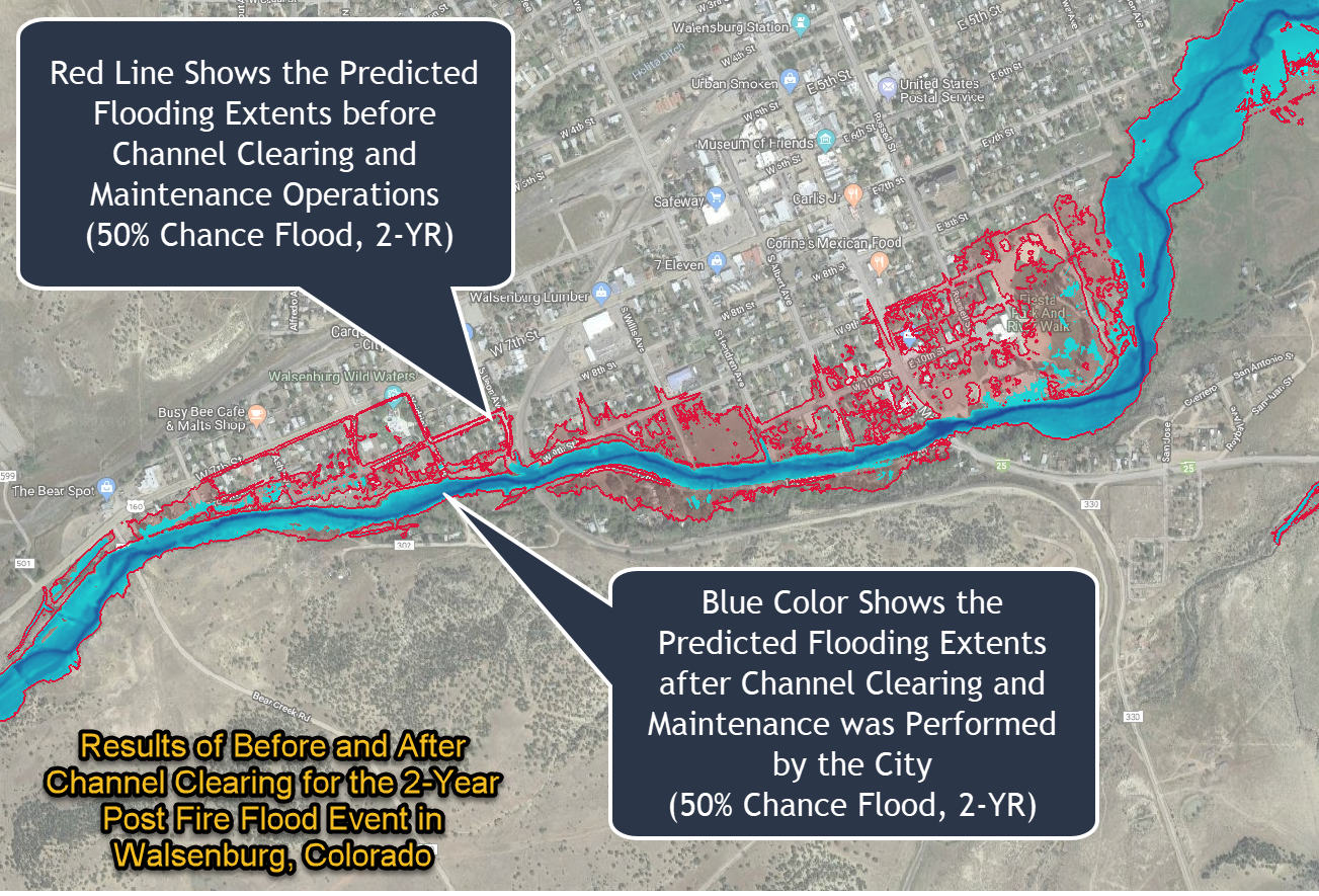
River Restoration Impact